
Discover a Harrison Township Street Directory
Use one defined street segment at a time. Harrison Township addresses pass through different record systems, and each system uses a distinct key. Start with the street number and road name in the township property system. Save the parcel number and legal description before moving to the map or deed index. That simple habit prevents a street search from blending a nearby parcel, a common area, or a differently numbered structure into the same result. A tax owner can be an individual, a trust, or an entity, so the record first establishes a parcel connection rather than household membership.
- Search the address in Harrison Township BS&A Online. Record the situs address, parcel number, legal description, owner or taxpayer field, and the tax year shown.
- Open the same location in Macomb County GIS. Check the parcel polygon, street label, and adjoining shapes before treating nearby structures as separate addresses.
- Search the recorded owner as a grantee in the Macomb County recorded-document index. The deed into that owner identifies the prior grantor and the legal description that ties the transfer to the parcel.
- For a person checking their own election details, use the Michigan Voter Information Center. Its address route is a voter-facing service, not a browseable street list.
- For an older household clue, ask the library for a Polk or Bresser reverse-directory volume and read the road in house-number order. Keep the printed year with every entry.
Note: A parcel number and legal description are the most durable handoff between map, assessor, and deed searches when a street label is inconsistent.
Harrison Township Street Directory in BS&A
BS&A Online is the practical first record for a current Harrison Township address. Its public search routes include Street Address, Street Number, Name, Parcel Number, and Building Department Record Number. Street text and a number range can help narrow a long road. If a range returns too many results, search smaller number blocks and retain the exact query. The system also offers property, tax, building, and utility routes, although available details vary by record type. The published research does not establish a historic start year, so a result should not be treated as proof of a complete earlier record.
| BS&A field | Input | Use on a street search |
|---|---|---|
| Street Address | Text | Find a road name or address text |
| Street Number | Number or range | Narrow the road to a block or segment |
| Name | Text | Check an owner, taxpayer, person, or entity spelling |
| Parcel Number | Text | Return to the same parcel after a map or deed search |
| Building Department Record Number | Text | Reach a building-specific record when one is known |
| Detailed Record Search | Link or control | Use expanded options when the public route exposes them |
The parcel card can show a situs address, owner or taxpayer, mailing address, legal description, class, values, exemptions, sale information, and links to related records. Those fields have different meanings. A situs is the physical parcel location. A tax mailing address is where correspondence goes. The displayed sample has a Harrison Township situs but an owner mailing address in Miami, a useful reminder that mail routing does not establish residence.
The BS&A search screen shows the Harrison Township street directory starting fields.
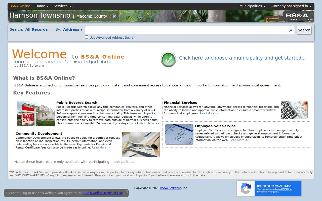
Use the displayed controls to record the parcel identifier before moving to a map or land-record search.
Harrison Township Street Parcels on GIS
The Parcel Explorer guide confirms parcel polygons, street labels, parcel selection, six graphic basemaps, six recent aerial basemaps, layers, and a Swipe comparison tool. Search an address or click a selected parcel, then record the visible boundary and adjacent parcel IDs or addresses. The map is best for spatial questions: which polygon touches another, whether a road fronts a parcel, and which public geographic layers apply. It is not a deed book or a verified roster.
Harrison Township sits on a Lake St. Clair peninsula divided by the Clinton River, with borders near Mount Clemens, Clinton Township, and St. Clair Shores. That geography can make a road or postal label seem straightforward when the legal parcel context is not. Turn on parcel and street layers first. Add Voting Districts, Flood Zones, Soils, Parks, or Trails only when that context helps interpret a map. The official guide does not confirm a current buffer, radius, export, or owner-popup tool, so do not rely on any of those functions without checking the live viewer.
The Macomb GIS Parcel Explorer places Harrison Township streets and parcel outlines in the same view.
A map click is a starting point: take its parcel number back to BS&A before assigning a record to a parcel.
Harrison Township Street Sale Records
The BS&A sale search is a useful timeline tool within an address search. Its public filters include sale-date and sale-price ranges, property-class checkboxes, bedroom and bathroom ranges for residential filters, and a neighborhood quick find. Pair a sale result with the parcel number and recorded deed rather than treating it as a complete chain of title. The research did not locate a stated coverage start, result limit, or export rule for this screen. A sale event can help establish when to look for an instrument, but it does not identify every person connected to a property.
| Sale date range | Use a from and to date in the displayed format. |
|---|---|
| Sale price range | Set numerical bounds when comparing events. |
| Property class | Agricultural, commercial, residential, industrial, timber cutover, or developmental filters are offered. |
| Neighborhood | Use the quick find or dynamic selector when the road needs local context. |
The Harrison Township BS&A sale search shows the filters available for parcel-linked sales.
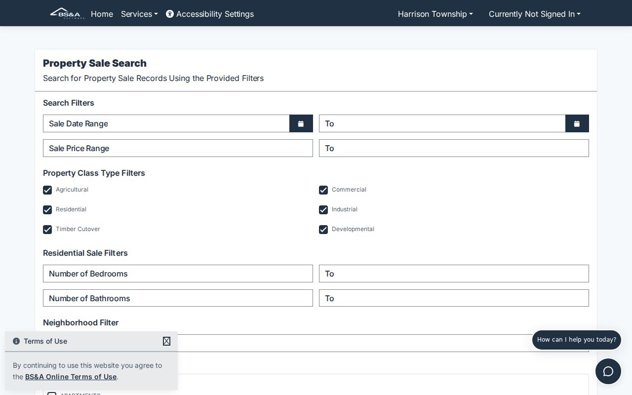
Keep the sale record beside the deed result so the event date and the recorded transfer can be compared without guessing.
Harrison Township Street Permits and Code Files
Address-keyed building files can add a construction, alteration, trade, or inspection sequence to a Harrison Township street record. The Building Inspections Department handles building, plumbing, mechanical, and electrical permits. Its online application path requires contractor registration before application, while homeowners do not need an account. It directs applicants to upload a completed PDF and notes bonds or administrative charges where applicable. The inspected material did not expose a complete public historical permit-result index, so a missing online result is a reason to contact the department, not proof that no file exists.
Code Enforcement has a complaint route and a 2025 complaint form, but no searchable public case ledger was located. A focused request should identify the address, approximate date, and record type, then go to the responsible custodian. A permit applicant, contractor, owner, taxpayer, and resident are separate roles. Keep that distinction visible when a property event names a person or business.
The Harrison Township permit and inspection page documents the local building-record route.
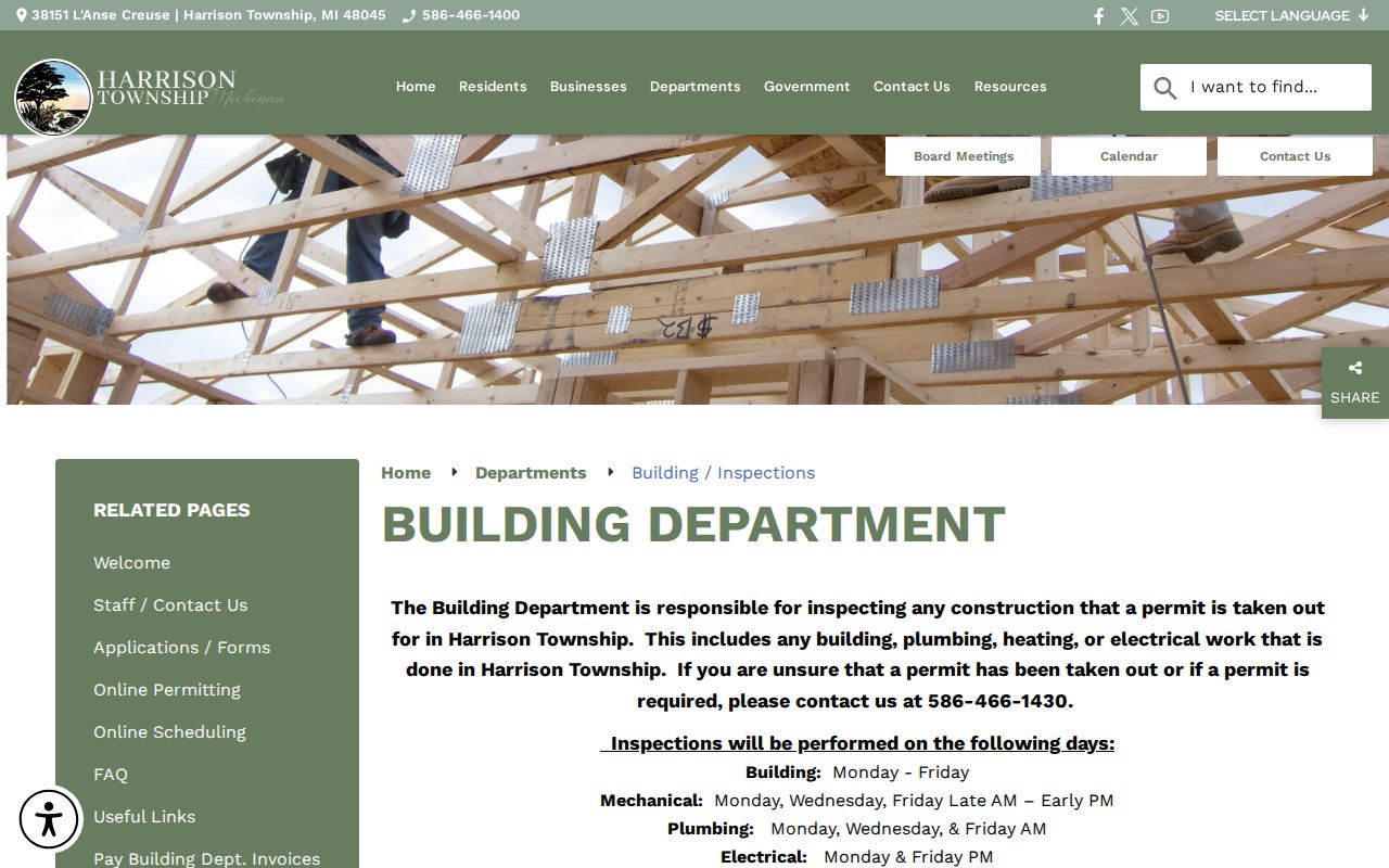
Older address files may require a department counter inquiry or a narrowly written Michigan FOIA request.
Harrison Township Street Deed Trail
The Macomb County Clerk / Register of Deeds index is grantor and grantee based. Search the current owner as grantee and use the approximate acquisition period. Open or order the deed into that owner, then capture the grantor, grantee, recording date, instrument number or liber and page, legal description, and any prior reference. Search the prior grantor as a grantee to find how that seller acquired the parcel. Repeat the handoff backward, keeping every record tied to the legal description rather than a street name alone.
The basic online index is free. County search options describe address, legal-description, parcel-ID, and name searches on the advanced route; document images and staff work can involve fees. In-person terminals at 120 N. Main Street in Mount Clemens provide free index viewing. A mail request can supply a document type, grantor or grantee, approximate date, property address, legal description, or lot. The exact online index cutoff was not located in official sources, so older research should ask the office where deed books or microfilm begin instead of assuming a year.
Note: A mortgage, discharge, lien, or assignment can explain a recorded event, but a lienholder is not necessarily a property owner.
Harrison Township Street Voter Access Limits
Michigan Voter Information Center offers name, license, and address modes for voter-facing registration and election information. Address mode requires a street address, city, ZIP, state, and an optional apartment or lot. It can return registration status, polling information, sample-ballot access, and related personal election tools when a record is matchable. It does not provide a public street-wide roster. A parcel result should never be used to infer that every adult, renter, or other household member appears in the election system.
A formal Qualified Voter File request can define a township, precinct, ward, school, district, county, or other stated geography. Permitted output and cost depend on the request. Protected fields and protected participants remain excluded, and the request form says the data must be used consistently with law and the form. For local election records that are not online, the Harrison Township Clerk is the first contact; Michigan FOIA, MCL 15.231 et seq. is the general request route for non-exempt public records.
Harrison Township Street Record Coverage
No source is a complete answer by itself. This Harrison Township street directory coverage table keeps the address key, record signal, and access route separate, so a reader can choose the next record without overstating the first one.
| Source | Address key | Record signal | Best use |
|---|---|---|---|
| BS&A property | Street, number, parcel, or name | Owner or taxpayer, mailing address, legal description | Current parcel starting point |
| BS&A tax | Parcel or address | Taxpayer, values, class, bill, payment, exemption fields | Date-specific tax context |
| Macomb GIS | Address, parcel, or map | Parcel outlines, districts, and land context | Street and block geography |
| Register of Deeds | Party, legal description, or parcel | Recorded transfers and encumbrances | Deed chain and prior owners |
| Building or code file | Address or record number | Construction or enforcement chronology where releasable | Structure history |
| Criss-cross directory | Street and house number | Historical head of household, status mark, phone where printed | Past address clue |
When the result is thin, use the parcel number to call Macomb County Land File for taxpayer or legal-description help, or ask the Register of Deeds for an in-person or mail search. That fallback avoids assuming that a failed street-text search means the address has no recorded history.
Harrison Township Street Record Terms
Four labels keep a Harrison Township street search from mixing land, mail, and historical household evidence. Keep each label beside the source that supplied it.
- Parcel
- A county or township property unit used to connect the map, tax card, and recorded land description.
- Situs address
- The physical location of the parcel or structure, distinct from where tax correspondence is sent.
- Plat
- A recorded subdivision map that can tie a lot or block to a road and legal description.
- Criss-cross directory
- A historical directory arranged by street and house number rather than by surname.
Use the legal description and parcel identifier when a current road label fails to match an older source.
Harrison Township Street Labels Over Time
Older sources may use Harrison Township, Harrison Charter Township, Harrison, Mount Clemens, or a post-office label. The University of Michigan atlas material pairs Harrison Township farmer-directory entries with a Mount Clemens post-office reference, which is a direct example of postal language differing from modern municipal identity. A historical road or street number should be copied exactly as printed first. Then test it against the parcel number, legal description, subdivision, lot or block, map, and deed.
The Library of Michigan Macomb guide lists Macomb County Road Names as a useful bridge. The research did not locate an official Harrison-specific renumbering or renaming year. Search both labels when a source supplies them, but do not declare them equivalent until a road-name list, plat, ordinance, or official map makes that link. For older land records, the deed description is usually safer than a guessed address conversion.
Harrison Township Streets in Criss-Cross Books
Reverse or criss-cross directories are the historic by-address layer. A Bresser-style book lists a road alphabetically and house numbers in order, then may give a head of household, telephone number, owner or renter indicator, year first listed, or a notation about a move. The exact Harrison Township run has not been confirmed by the public library catalog, so request the volume title, publisher, year, and geographic coverage from the librarian before relying on a particular edition.
The Library of Michigan city-directory guide explains the Polk and Bresser formats and points to print shelves, microfilm, and licensed databases. Historical volumes belong on the city-directory shelf, not in a modern parcel analysis. When an address investigation becomes a household-history question, the Harrison Township city directories provide the fuller collection and entry-reading method.
Harrison Township Street Directory Boundaries
Public address records stop at meaningful boundaries. A tax roll is not a household census, and an owner mailing address can be far from the parcel. A permit application may name a contractor rather than an owner or occupant. A voter-facing lookup is not a block export. Utility customers, delivery recipients, motor-vehicle addresses, and many household details are not public through the routes described here. Michigan's Address Confidentiality Program also protects eligible participants through substitute-address and mail-forwarding procedures.
Ownership, mailing, and residency are not interchangeable terms. Treat an ambiguity as a reason to seek the next official record or to stop, not as permission to fill a gap with an assumption.